How to use the Ferret polymark command
Below is an annotated version of the script polymark_demo.jnl
polymark_demo.jnl (5/99)
Description: demonstrate usage of polymark jnl file: Make a basemap to show the location, and plot (lat,lon,sst) triples on the map.
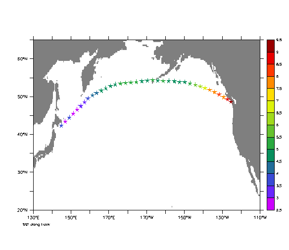
! Open demo ship track file with Lat, Lon, and SST

  yes? USE polydata

  yes? GO basemap X=130:250 Y=20:65 20
  yes? GO polymark POLY/OVER/KEY/TITLE="SST along track" lon lat sst star
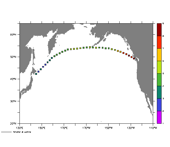
! A little smaller & outline the symbols using qualifier /LINE

  yes? GO basemap X=130:250 Y=20:65 20
  yes? GO polymark POLY/OVER/KEY/LINE/FILL/LEV=(1,9,1)/TITLE=
     "Smaller & outline" lon lat sst square .6
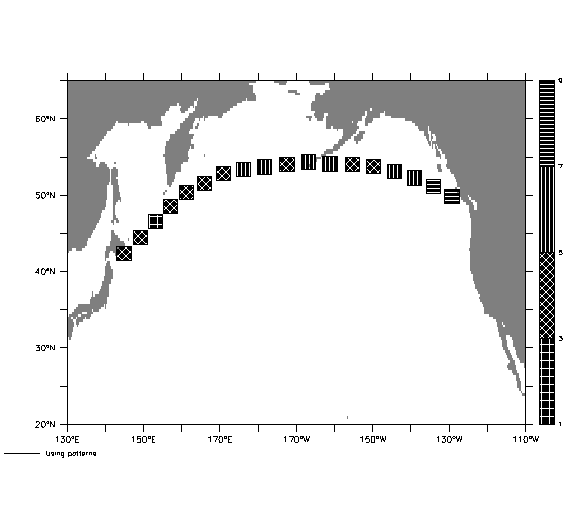
! Use a square in a pattern & outline (the long polymark command wraps onto
! the next 2 lines.)

  yes? GO basemap X=130:250 Y=20:65 20
  yes? GO polymark POLY/OVER/KEY/PATTERN=4patterns/PALETTE=black/LINE/FILL
     /LEV=(1,9,2)/TITLE="Using patterns"
     lon[I=3:37:2] lat[I=3:37:2] sst[I=3:37:2] square 1.75
oar.pmel.contact_ferret@noaa.gov
18 Jun 1999