![[Output Graphic]](color_pal/pal_colorgray.gif)
How can I find a good color palette for my plot?
! Plot sst
     USE coads_climatology
     SET REGION/L=1
     SET VIEW ul
     FILL/NOLABELS/PALETTE=ocean_temp sst; GO land

! plot temperature minus mean with a centered palette
     SET VIEW UR
     FILL/NOLABELS/PALETTE=white_centered sst - sst[x=@ave,y=@ave]; GO fland

! use a greyscale paletete
     SET VIEW LL
     FILL/NOLABELS/PALETTE=greyscale sst; GO land

! plot a relief map using the land_sea palette
     USE etopo120
     SET VIEW lr
     FILL/NOLABELS/PALETTE=land_sea rose
See the Ferret Users Guide Commands Reference section 20 (palettes), and Chapter6, section 5.2 (palette creation) for more on specifying a palette with the plot commands, and about the different kinds of palettes. There is also a Palette demo about the different kinds of palettes.
Also see the FAQ, How can I produce a plot with both colors and patterns? for an example using the pattern fill and shade keys, and Got any good ideas for black & white graphics? for a discussion of filled plotting using black and white palettes and patterns.
Here is a table showing the available palettes. For the Percent
palettes, the script "go try_palette palette_name" has been used to make
the examples. This shows the palette at several different resolutions.
The Levels and Values palettes are shown with examples from
datasets to point out their advantages.
| Palette name | Description | Type of Palette | Example Plot | ||
| default | The default palette; range through a rainbow of colors | percent |  |
||
| ocean_temp | Shows range of ocean temperature by value, so plots with different ranges of values will have the same colors for given temperatures. These two plots are the same except for the region. | value | 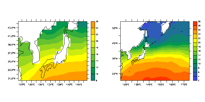 |
||
| rainbow_by_levels | A variety of colors assigned by level: each level gets one color. The LEVELS qualifier is used to specify six levels for the first plot and eighteen for the second. | level |  |
||
| rainbow | The same as "default" | percent |  |
||
| rnb | The same as "default" | percent | 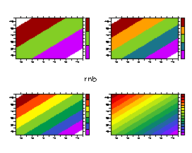 |
||
| rnb2 | Another rainbow of colors | percent | 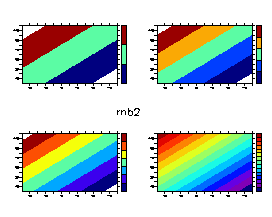 |
||
| saz2 | Yet another rainbow of colors | percent | 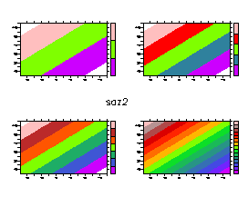 |
||
| light_rainbow | Similar to rainbow, but with washed-out lighter colors | percent | 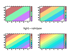 |
||
| broad | Designed to distinguish levels over a broad range | percent | 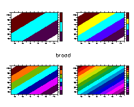 |
||
| dark_land_sea | For topography/ bathymetry plots. Brown and green on land, blue for sea | percent | 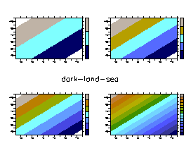 |
||
| land_sea | A lighter palette for topography/ bathymetry plots | percent | 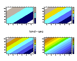 |
||
| ocean_blue | A range of blues for bathymetry plots | percent | 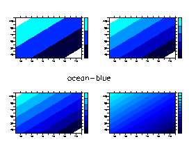 |
||
| dark_terrestrail | A range of green and brown for topography plots | percent | 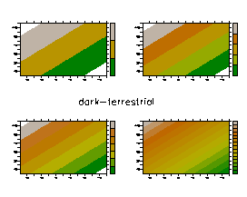 |
||
| terrestrial | A lighter palette for topography plots. | percent | 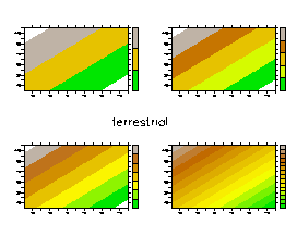 |
||
| modulo | A palette whose colors on either end match | percent | 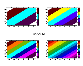 |
||
| no_blue | Palette with no blue tones | percent | 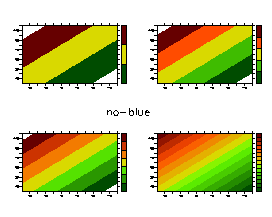 |
||
| no_green | Palette with no green tones | percent | 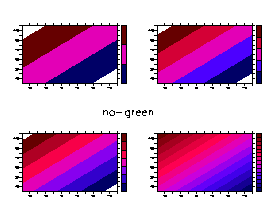 |
||
| no_red | Palette with no red tones | percent | 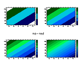 |
||
| low_blue | Palette with low ammount of blue | percent | 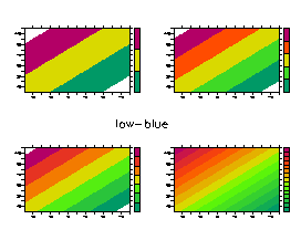 |
||
| low_green | Palette with low ammount of green | percent | 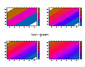 |
||
| low_red | Palette with low ammount of red | percent | 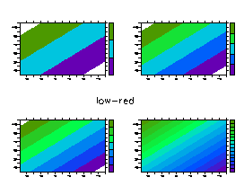 |
||
| centered | Distinguishes values above and below the middle level; warm colors above and cool colors below. | percent |  |
||
| white_centered | Another centered palette with white as the central color | percent | 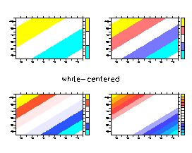 |
||
| no_blue_centered | Another centered palette with no blue tones | percent | 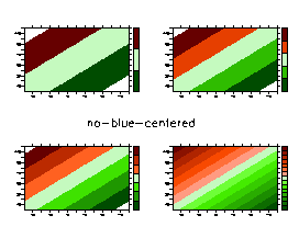 |
||
| no_green_centered | Another centered palette with no green tones | percent | 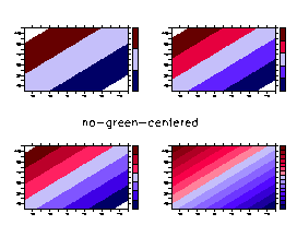 |
||
| no_red_centered | Another centered palette with no red tones | percent | 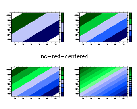 |
||
| grayscale (also greyscale) | Series of grays | percent | 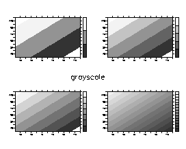 |
||
| inverse_grayscale
(and inverse greyscale) |
With high and low reversed | percent | 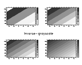 |
||
| bluescale | Series of blues | percent | 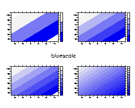 |
||
| inverse bluescale | With high and low reversed | percent | 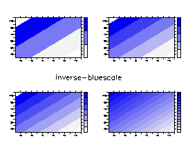 |
||
| greenscale | Series of greens | percent | 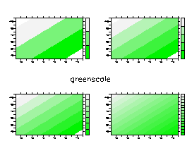 |
||
| inverse_greenscale | With high and low reversed | percent | 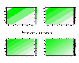 |
||
| redscale | Series of reds | percent | 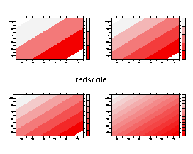 |
||
| inverse_redscale | With high and low reversed | percent | 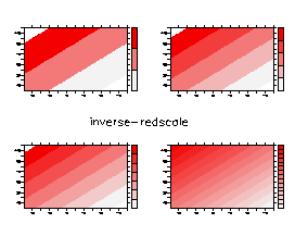 |
||
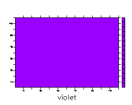
Single colors
|
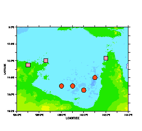
One color in the palette. These are useful for colorbars, filling between curves, making backgrounds, and filling polygons to make different colored dots on a plot, as in marking station locations. For examples see the FAQ: How can I fill between two curves? and the Ferret v5.6 release notes | percent |
|
Last modified: April 7, 2004
The requested URL "/footer.txt" was not found on this server.