Map Projections in Viewports
Question:
How can I get the right aspect ratio for map projections in viewports?
Example:
Solution:
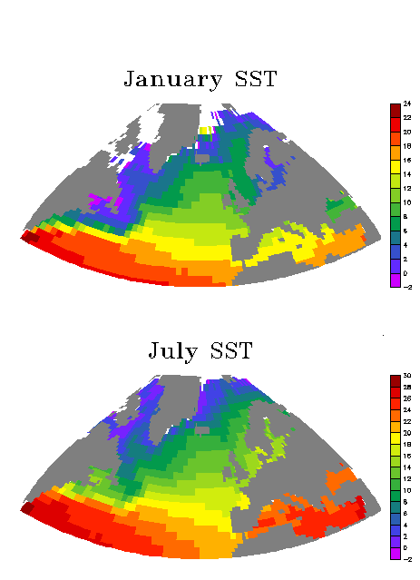
The above graphic was created using the mp_viewport_aspect.jnl script.
 set win/size=.4/aspect=`11/8.5` ! set up desired page size and aspect
 use coads_climatology
 set grid sst ! out of habit, for map projections
 shade sst[l=1] ! to initialize the window
 set region/x=80w:40e/y=30n:80n
 go mp_bonne
 go margins 0.4 0.4 0.4 0.8 ! to specify narrow margins
 go mp_viewport_aspect 0 1 0 1 mp_vp1
 shade/noaxis/nolabel sst[l=7], x_page, y_page
 go mp_fland
 go mp_label 340 85 0 0 .3 "@TRJuly SST"
 go mp_viewport_aspect 0 1 0.5 1 mp_vp2
 shade/noaxis/nolabel sst[l=1], x_page, y_page
 go mp_fland
 go mp_label 340 85 0 0 .3 "@TRJanuary SST"
Further information on the use of this script is available inside the script.