Last modified: Tue, 03/21/2017 - 23:56
New features and bug fixes in the current release
Ferret Version v6.1 Release Notes
24-March-2008
Version 6.1 is required for users who wish to install the LAS (Live Access Server) software, Version 7.0. It also has a few bug fixes and additions for non-LAS users.
If you will be installing LAS Version 7, you will need to download and install the datasets and Ferret environment files that are included with this Ferret release.
This Ferret release includes executables for Linux 32-bit and 64-bit, and and a statically-linked linux executable, for other Unix systems. Altix ia-64 and Solaris builds will be built and released when they are ready.
Enhancements and Bug fixes in Version 6.1
- A new MODE lets us pre-set the number of color fill levels, changing it from the default value of 10. Watch for additions to this capability in future versions as we add ways to set both the contour lines and color levels in more automatic ways.
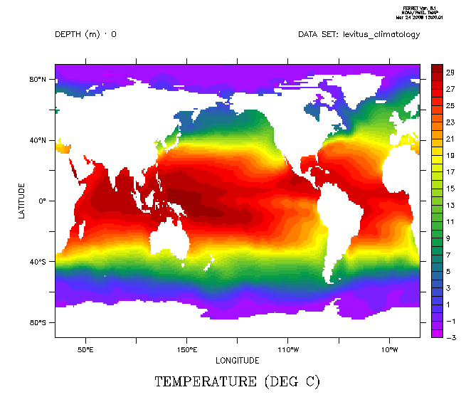
 yes? SHOW MODE nlevels
 MODE STATE ARGUMENT
 NLEVELS SET 10
 yes? SET MODE nlevels 40
 yes? Use levitus_climatology
 yes? FILL/K=1 temp


! As always SET MODE/LAST nlevels restores the previous setting.
yes? SET MODE/LAST nlevels
! As always SET MODE/LAST nlevels restores the previous setting.
yes? SET MODE/LAST nlevels
- A new qualifier is added to SHADE. SHADE/TRIM allows us to easily draw a SHADE plot underlying a FILL plot if we wish to use this method to fill in sparse data. The FILL command needs contiguous data to interpolate contours, and it draws color fill only to the coordinates, which are generally in the middle of the grid cells. FILL trims off the extra half-cell around the edges of a plot. A SHADE plot by default fills in each entire grid cell. The SHADE/TRIM qualifier trims the half-cells for a SHADE plot as well.
 yes? SHADE/TRIM var
 yes? FILL/OVER/LEV var
Try this script if you're interested in seeing what this is good for
yes? SET MODE nlevels 40
yes? USE coads_climatology

 ! Here is a simple FILL plot
yes? FILL/LINE/L=5/X=-50:-20/Y=-65:-25 sst

 ! A shade plot shows there is more data towards the south
 ! that is too sparse to be FILLed with the contouring algorithm.
yes? pause
yes? SHADE/L=5/X=-50:-20/Y=-65:-25 sst

 ! We could overlay a FILL plot on the SHADE plot to show all
 ! of the available data
yes? pause
yes? FILL/LINE/OVER/LEV/NOLAB/L=5/x=-50:-20/y=-65:-25 sst

 ! But look around the edges of this. Standard SHADE puts color
 ! out to the edges of the grid cells but FILL cannot extrapolate there.

 ! SHADE/TRIM shades only to the coordinate locations, matching the
 ! region where FILL operates, and overlaying FILL shows all the data
 ! using FILL contours where that is possible
yes? pause

yes? SHADE/TRIM/L=5/x=-50:-20/y=-65:-25 sst
yes? FILL/LINE/OVER/LEV/NOLAB/L=5/X=-50:-20/Y=-65:-25 sst
- Fixes are made to metafile batch mode. Starting Ferret with ferret -batch yields graphics files that are identical with the same scripts run in interactive Ferret startup mode, or with ferret -unmapped.
- If a time axis includes years 0000 or 0001, we previously did not list the year in all listings that include formatted dates. This was because these years often represent a climatology, but that is not always true for time axes. We now list the year, if the axis is not a climatological (modulo) axis. So, for instance, a listing that previously looked like this (note the year is missing in the first 2 years)
yes? DEFINE AXIS/T="15-jun-0000":"15-jun-0006":1/UNITS=year yax
yes? LIST T[GT=yax]
 VARIABLE : T
 axis YAX
 SUBSET : 6 points (TIME)
 JUN / 1: 0.454
 JUN / 2: 1.454
 JUN-0002 / 3: 2.454
 JUN-0003 / 4: 3.454
 JUN-0004 / 5: 4.454
 JUN-0005 / 6: 5.454
now has consistent formatting of the dates:
yes? DEFINE AXIS/T="15-jun-0000":"15-jun-0005":1/UNITS=year yax
yes? LIST T[GT=yax]
 VARIABLE : T
 axis YAX
 SUBSET : 6 points (TIME)
 JUN-0000 / 1: 0.454
 JUN-0001 / 2: 1.454
 JUN-0002 / 3: 2.454
 JUN-0003 / 4: 3.454
 JUN-0004 / 5: 4.454
 JUN-0005 / 6: 5.454
- (Needed only by LAS developers) The xml-style output from SHOW DATA/VAR/XML and SHOW AXIS/XML has more items listed.